Travel, Adventure and Photography

Thursday, December 20, 2007

BhogaNandishwara, Nandi Hills.

This is my Nth visit to Nandi Hills.
While coming back, we visited 'Bhoga Nindishwara' temple on the base of Nandi Hills at a village called 'Nandi'. Bhoga Nandishwara Temple follows the Dravidian style of architecture.
This temple has a huge 'praakaara' (compound), a 'pushkarini' (pond) and a beautiful 'mantapa'. The main temple, 'pushkarini' and the 'mantapa' have their own enclosure within the temple compound.
Route: Best thing is to visit Nandi Hills first and then ask villagers for the route to Nandi village while coming back

Photos :
Link to BhogaNandishwara Album


Thursday, December 06, 2007

Ranganatittu and Somanathapura

It’s been a long time since our 'Thomson' group went for a trip. We had been to Ranganatittu ( a bird sanctuary near Mysore) and Somanathapura Temple ( an old temple built by Hoysalas) two weeks ago (24th Nov 07). It is one day trip. We started from St. Marks Road at 7 AM, after waiting 30 mins for Maheshwar. Had nice breakfast at Kamath Lokruchi. It took nearly 2.5 hours to reach Ranganatittu. (One has to take a right turn towards Hunsur, 3~5 kms after Srirangapattana). Its was off season and we could see only 5/6 varieties of birds.

Two type of boat rides are offered here 1) Public (need to wait till boat gets full and 15 mins, 25 Rs per head) 2) Private (30 mins - 250 Rs). We opted for second and shared the cost with another group of two. The gurd who took us for the boad ride was very helpful and he showed us all birds in their natural habitat and helped us in photographing the birds. We had Lunch in the Canteen there, which was not bad.

We spent nearly 3 hours there and started towards Somanathapura. This is an old temple built by Hoysalas. Architecture is similar to Belur and Halebidu. One good thing is that this temple is not destroyed. Most of the sculptures are intact. Its took an hour and a half to reach Somanathapura. Spent an hour there clicking the photos.
Reached Bangalore by 7 PM .

Team: Myself, Chetan and Maheshwar
Date: 24 - November -2007
Route:
Ranganatittu: Bangalore -> Ramanagara -> Mandya -> Srirangapattana -> (3~5 Kms) Road towards Hunsur on the right side -> (500 mts) Ranganatittu Sanctuary.

Somanathapura : Ranganatittu -> Srirangapattana -> Srinivasa Agrahara (After 1~2 kms from Srirangapattana, need to take a right turn immediately after a bridge. Ask locals) -> Karighatta -> Banoor (Roads are BAD) -> Somanathapura (Very BAD roads)

Expense: 600 per head.

PHOTOS:
Link to Ranganatittu photos.
Link to Somanathapura photos.

Tuesday, November 06, 2007

Kumara Parvatha

I had been to Kumara Parvatha (KP) twice during my college days .
This is the travelouge of our second trek to KP and we experienced the best there.

Information:

Kukke is accessible only by bus for the time being. You have to catch a bus to Kukke/Subrahmanya form Bangalore or Mangalore. There are a lot of buses from Bangalore. But you need to book the tickets in advance if you are traveling on the weekends. The journey to Kukke takes nearly 10 hours from Bangalore and around 3.5 to 4 hours from Mangalore.
Ideal time for the trekking would be January to March. Its a good decision to carry a tent/large plastic sheet if you are planning to camp. [Now a days you need to obtain permission form range forest office if you are planning to camp on the peak. Please note that alcohol is prohibited and the gurds check the baggage sometimes.]

Dress: A pair of jeans, shorts, cotton t shirt, a warm pull-over and comfortable old walking shoes.
Food: Ready to eat/dry rotis/chapathis for two days, some chocolates, snacks, glucose/electral, and a lot of water.
List: A torch, camphor, 10 mts of strong rope , a strong knife, some old news papers, match box / lighter, plastic sheet / tent and misc items which you need.


Travelogue:
We decided to go for a weekend trekking to Kumara Parvatha. All of us were studying at Mangalore University then. But one week before the fixed date we came to know that the same Saturday would be our convocation day for graduation. So we started to think what to do, and which is important...finally the trekking won over Convocation...!
[This is one of the toughest Peaks in Western Ghats.]

Day One:
Friday afternoon 2.30, Five of us (Myself, Murali, Shyama, Anil,Ramesh,Harsha and Hari) were waiting for a bus to Puttur, in the waiting shed out side the campus. Had a fear that any of the profs might catch us...nothing happened. We boarded the private bus to Puttur.
Evening 5.15 we were at Puttur Bus Stand, form here we had to go to Subrahmanya (Also called as Kukke or Kukke Subrahmanya). Last bus was at 5.45. It started at 6 PM and we reached the destination at 8 in the night. On the way we observed that its drizzling outside.. some of us were tensed because if it rains we cant camp at night on the peak. Finally we reached Subrahmanya and took two rooms at Mayura Residency . Its a fairly good hotel. Had food and said good night to Subrahmanya.

Day Two:
Got up at 5.30 in the morning. It took an hour for all of us to get ready. At 6.30 we were in front of the hotel where we had ordered for 40 chapathis and solid chutney ('gatti chutney'). We also packed idlis for the breakfast on the way. We shared the load among ourselves.
Flash Back: For myself, Murali, Ramesh and Shyama this is a second time experience. When we came here for the fist time we had food at Girigadde Bhatta's house. This time we decided that we will carry food ourselves.
Girigadde Bhatta's house is situated around 6~8 kms from Subrahmanya town. His house is the only house in approximate 20~30 sq kms. There is no road approach to his house. You can reach there only by walking. He comes to Subrahmanys town everyday morning to sell milk to the co. operative milk society. If told in advance at Hotel Kumara Krupa in Subrahmanya, he cooks food for trekkers. But if you are planning to have food at his house, please carry some rice and vegetables and grocery along with you, because it will be helpful for him. Just remember that he has to carry all the grocery on his head up-hills, where its difficult for us to even walk. Off course he will charge for food but he will deduct whatever the amount of grocery you carry along with you.
At 7 we were on the way to Kumara Parvatha. [You can ask the direction with any shop keepers around. They will never misguide you.] You have to walk around 2 kms to reach the base. There is a small 'bus shelter' kind of thing and as I remember there was a small board indicating direction to Bhatta's House. Just catch that path and start walking up-hills. On the way you will meet a lot of leaches and I will assure you that at least 3-4 leaches will bite you if you do not cover yourself fully and rub tobacco on your shoes, pants and wherever possible ;)]
We finished all idlis we had brought for breakfast on the way. With a lot of breaks and lot of sweating and sighs, we reached Bhatta's house at around 11.30. [Near his house there is a forest check post and the guard over there will check your baggage and advice you with a lot of do's and dont's. Please cooperate with him] Had a long break of half an hour at his house, drank the natural mineral water. And we started off at 12.15. It took around an hour and a half to reach the stone shelter (called as 'Kallu Mantapa'). By 2 in the afternoon we were opening the packed chapathis and chutney ..and within no time we finished 15-16 chapathis and buckets of water. [Before the stone structure, there is a small pond from which you can re-fill your water resources]
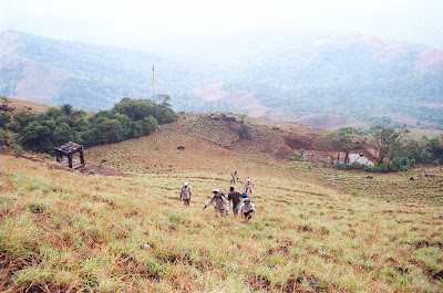
Again after some rest and we were back on the path. After the stone structure there is a beautiful hill which is called 'Bhattada Raashi' which literally means a huge pile of rice grain. After this hill, we walked 2~3 kms on hilly area. Suddenly forest area starts...I don't know how there is a sharp line of differentiation between the grass lands and forests. It is so thick that you cant even see the sunlight. We reached here around 3.30 PM. From here the path/trail is little steep and sometimes you may need to crawl using both hands. Also its an edgy trail, a slip would end up in your end.
We reached the peak at around 5.30. Quickly we set up the tent. [Our tent was nothing but a huge 12X12 sheet of plastic sheet]. Before the tent was complete it started raining cats and dogs. Myself and Hari set it up and slipped inside and waited for the rain to stop. There was heavy lightning and thunder outside. Whenever there was a heavy lightning our tent used to get charged and all of us could feel it. Rain stopped after half an hour we started collecting fire wood. We were able to collect a few wet small logs and cut branches. We had a few old news papers and with the help of that a a little petrol which Murali carried we were able to lit a small fire.
It was a lovely experience sitting out and eating food in that cold whether. One of us was always awaken and we changed the duty of guard one by one.

Day Three:
I got up by 5 in the morning and saw that all were sleeping and also I remembered that I was the person who was supposed to do the guard duty. ;). Every one woke up and finished the daily chorus in a 'natural way'. Our journey back towards Subrahmanys took around 7 hours. That was a plain simple walk.
Had lunch at a hotel and took a bus back to Mangalore.
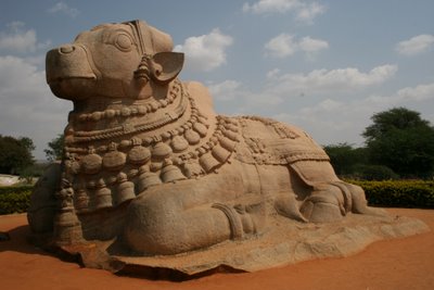
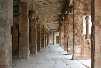
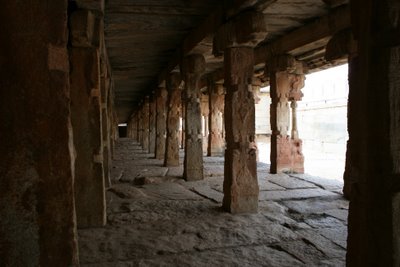
PHOTOS:

All Photos are taken by Murali on his Olympus OM2000 film SLR:


Tuesday, October 16, 2007

Few Shots.........

Yesterday I came home little early. Utilized time like this :


Link to my album 'Few Shots........'

Wednesday, September 12, 2007

Belur, Halebidu and Shravanabelagola

Last Saturday I had been to Beluru, Halebidu and Shravanabelagola. Left to Halebidu from Bangalore at 7 Am on 08/09/2007.
Halebidu is 230 kms from Bangalore. Which is an old star shaped temple built by 'Hoysalas'. It has amazing carvings on the walls.
Beluru is 17 kms from Halebidu. Again, this is another temple built by Hoysalas and comparatively less destroyed then Halebidu. Stories say that this temple was covered by sand during the destruction caused by 'Malik Kafur'.

Shravanabelagola is approx. 90 kms from Beluru and it is famous for a huge monolith of lord 'Gommateshwara'. The statue is located on a hill called Vindhyagiri,. We have to climb 500+ steps to reach the top.

Route : Bangalore -> Nelamangala -> Hassan -> Halebidu -> Belur -> Shravanabelagola -> Nelamangala -> Bangalore
Duration : One day
Trip Meter : 500+ Kms.

Photos:

Beluru

Halebidu


Shravanabelagola

Tuesday, September 04, 2007

Mullaiyanagiri

This is the fastest trek ever I did. We, a group if 6, left Bangalore by 11.30 PM of last Friday (31/08/07) and were back at Majestic by 8.30 PM the next day. But the experience was wonderful.

We reached Chikkamagalur by 4.45 in the morning. It was amazing to see a hotel open in the bus stand at those morning hours. We had the breakfast of idli and uppittu at 5.30 AM. Asked the cashier about transport to the starting point of trek. He suggested us to hire a vehicle as the first bus in that route starts only after 7.30.

We came out and hired an old Ambassador to take us to 'Sarpadaari' (Sarpa Daari - Snake route), which is the starting point of the trek to Mullaiyanagiri. We started the trek at 6.15 in the morning. There was no rain, but the mist was so heavy that all of us got drenched within 15-20 mins of walk.

The climb is steep right from the beginning. There are multiple routes, but none of them are confusing. Just take the most used and clear path which takes you uphill. After 60 - 70 mins of trek we came across a huge monolithic rock and took rest there for a while. After the rock, there is a small statue of Nandi. These are the 'landmarks' to ensure that we are on the correct route. Visibility was limited to 10 mts. max due to heavy fog.

After climbing for an hour again we reached the twin caves just below the peak. Had our second breakfast there. The caves are located just below the peak. We reached the peak at 8.30 AM, after 2.15 hrs of trek.

The wind was blowing as if someone is spraying pressurized air mixed with water!!!!!!!!!!!!!!!!!. There is a temple at the top. Please remove your footwear before entering the compound. The family which is looking after the temple aslo provides breakfast and lunch on request. We spent nearly an hour on the top. It was chilling and the wind was blowing at high speed.

We were being pushed aside by the wind when we started descending towards Seethaiyana MaTha. We took another route where we had to descend through 200 +/- steps and walked around 3 kms to reach the Seethaiyana MaTha. This route opens you to a wonderful , greeting card image like valley.

We reached the MaTha by 11 AM. We had called the Ambassador guy from the peak and asked him to come to the MaTha by the same time. From here we went to Baba Budan Giri to visit the shrine of the saint, Manikyadhara falls and reached back to Chikkamagalur by 2 PM. Took the Volvo bus at 2.30 PM back to Bangalore.

Team size: 6
Expenses: 825 per head.
Summary : Bangalore -> Chikkamagalur (Bus, ~250 Kms / 6 Hrs) -> Sarpadaari (Car, 15 Kms) -> Mullaiyanagiri Peak (Walk, ~4 Kms) -> Seethaiyana MaTha (Walk, ~3 Kms) -> Baba Budan Giri (Car, ~20 Kms) -> Chikkamagalur (Car, ~ 35 Kms)

Photos:
Link to my picasa web album.


Thursday, August 23, 2007

Jog Falls

I had been to Jog Falls on 11th and 12th of August. It was raining hevily and the waterfalls was in full flow. Also the crowd was heavy.


Its amazing to watch the falls as the fog clears. When we went there we could only hear the roaring sound. After nearly half an hour, the fog cleared and ................... there it is !, the famous Jog Falls. The view was worth driving nearly 400 kms from Bangalore and back.


The fog and the falls keep on playing hide and seek.


The route : Bangalore -> Nelamangala -> Tumkur -> Arsikere -> Kadur -> Birur -> Tarikere -> Bhadravathi -> Shivamogga -> Sagara -> Gerusoppe (Jog Falls)

Road between Arsikere and Bhadravathi is below average and other stretch is good.

Photos :


Sunny Sun Flower farms on the way.


Falls & Fog - 1

Falls & Fog - 2

Falls & Fog - 3

Tuesday, August 21, 2007

Khandala

I had been to Khandala on 20th of July, my last day at Pune.। Did nothing but took some snaps and returned.


Photos:


Sunday, August 19, 2007

Kenjalghad and Raireshwar


On June 23rd we had been to Kenjalghad and Raireshwar fort near Satara। This is the one and only trek I had ever done during my stay at Pune. This trek was organized by JOSH team of TechM. I do not know the route and the approach. But the environment was stunning and beautiful. It was raining and the total trek length was around 15 to 17 Kms. Monsoon treks in Sahyadri range rocks !!!!.

Photos :


Fog covered Raireshwar Fort
Misty Mountains

Misty Mountains II

Rock on which Kenjalghad Fort is located.

Friday, February 23, 2007

Lepakshi....

Lepakshi

Last Monday (19 - 02 -2007) we had been to Lepakshi. Which is 120 kms from Bangalore.
Monday was a holiday (only in US and a few companies in Bangalore !!!!!!!!) , so we decided to go somewhere and this 'somewhere' became Lepakshi by Sunday evening.

Places of interest : A 'nandi' carved out of huge monolithic rock and an old huge temple built in 15th century .

Route : BGL ->Yelahanka -> Devanahalli -> Chikkaballapur -> Bagepally -> Andhra Boredr (Kodikonda) -> Take a left (Hindupur road) ->14~15 kms to Lepakshi.

Photos :